IEEE Transactions on Intelligent Transportation Systems 2011
vol. 12, no.4, pp. 1587-1598Interpolating sparse GPS measurements via relaxation labeling and belief propagation for the redeployment of ambulances
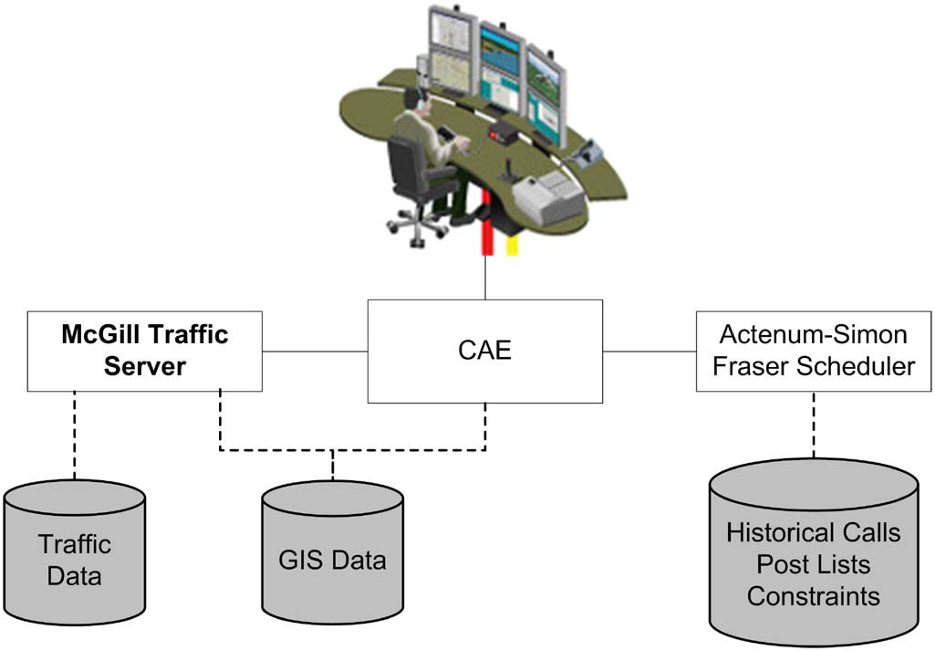
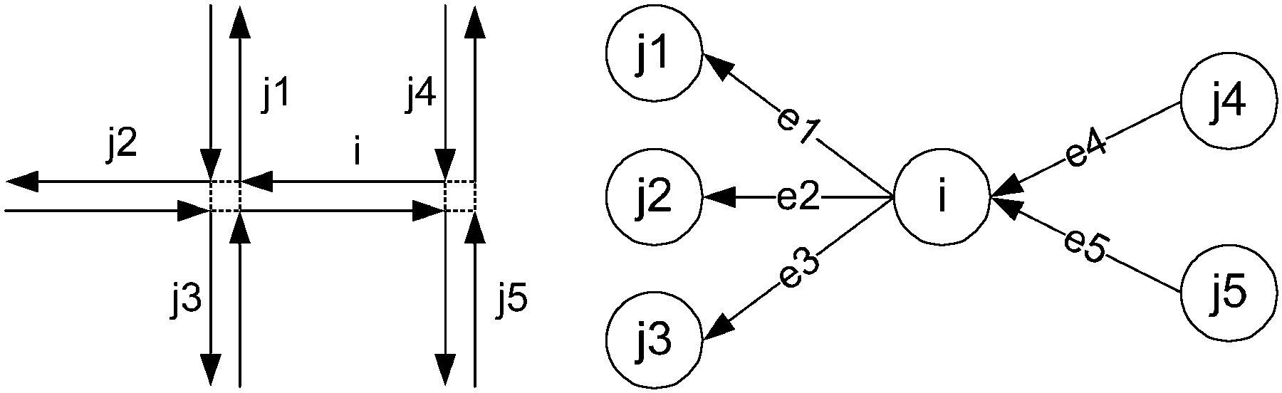
RISER system overview (left) and graph representation of a simplified road network (right)
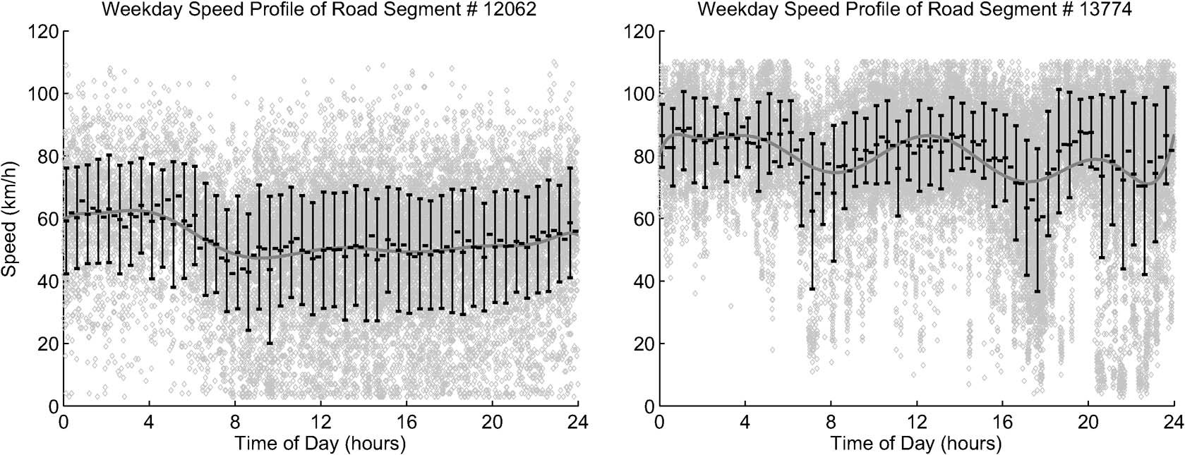
Weekday speed profiles for two different road segments based on historical data
Abstract
One major challenge for traffic management systems is the inference of traffic flow in regions of the network for which there are little data. In this paper, Global-Positioning-System (GPS)-based vehicle locator data from a fleet of 40–60 roving ambulances are used to predict the most likely ambulance speeds in a network of 20 000 streets in the city of Ottawa, ON, Canada. First, the road network is represented as a directed graph data structure. Then, we compare two algorithms, i.e., relaxation labeling and belief propagation, that interpolate the sparse and noisy measurements from the fleet to obtain dense locally consistent ambulance speeds. Unlike several other systems in the literature, we model all of the city’s freeways and surface streets, and both road types are treated with equal importance. Furthermore, the data structure and algorithms described in this paper are not only extended to real-world needs such as road closures and the incorporation of live data with historical data but are also computationally efficient, providing updates in intervals of less than 5 min on commodity hardware. Presented experimental results address the key issue of validating the performance and reliability of the system.Files
- phan2011interpolating.pdf - article
Bibtex
@article{phan2011interpolating,
  title={Interpolating sparse GPS measurements via relaxation labeling and belief propagation for the redeployment of ambulances},
  author={Phan, Andrew and Ferrie, Frank P},
  journal={IEEE Transactions on intelligent transportation systems},
  volume={12},
  number={4},
  pages={1587--1598},
  year={2011},
  publisher={IEEE}
}